

As someone who grew up in the city, I couldn’t imagine what it was like to visit the desert until I visited the park. Yes, you heard that right, this park is not a walk through blooming hillsides and deep forests. But it’s not a dry, forbidden landscape. I was surprised to find it quite a resilient garden. I have awe for an ecosystem that can support so much hidden wildlife and plants on so little water.
5 INTERESTING FACTS
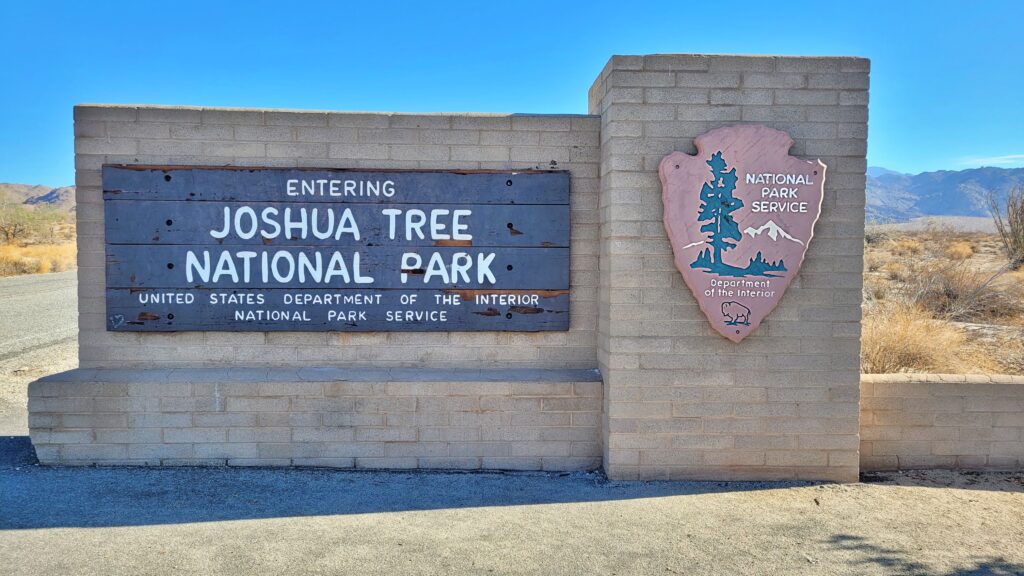
ABOUT JOSHUA TREE NATIONAL PARK
- Joshua Tree is part of two different desert systems. The northwestern half of the park is part of the Mojave Desert (which also includes Las Vegas and Death Valley National Park).
- The southeastern part of the park is part of the Colorado Desert (which also includes Mexicali, the Salton Sea, and Lake Havasu).
- At the instigation of Minerva Hoyt, Joshua Tree National Park became a national monument in 1936. It was not declared a national park until 1994.
- The park is home to 57 species of mammals.
- The park is visited by nearly 3 million people each year, so you should plan your visit carefully.

IS THERE MOBILE SIGNAL AVAILABLE IN THE PARK?
Absolutely not! Cell phone service in the park is not just bad, it’s nonexistent. That can be refreshing if you want to communicate with nature and not be disturbed on your way. But it has its pitfalls. If you get lost, unfortunately, there’s no way to call anywhere. And guess what? Yes, I got lost. And why did this happen to me again? As is my habit, here in the park I mainly took pictures of details. And when I’m taking pictures, I’m so absorbed in it that I don’t notice the surroundings.
Suddenly I looked back and my other family was in a daze. I didn’t panic. I knew there was no signal here, so I prepared myself properly. I downloaded the offline maps. Or at least I thought I had downloaded them. Well, of course I didn’t check. I only downloaded part of the state of California.

At first I followed the signs, so I was pretty comfortable. But then I made the fatal mistake of mistaking the name of the trail I was on. Suddenly I found myself on the wrong road, but in the end it all turned out well. A young American couple driving along the road must have noticed that I was a woman in trouble. They drove me to the place where I was supposed to go. It cost my family nerves, because they were afraid that I would get lost and they would have to call the emergency number and a helicopter would have to look for me. It cost me my cap, which I had forgotten in the American couple’s car.

MY TIP:
Take a paper map with you. Just do it the old fashioned way. 🙂 Make a plan in advance and stick to it.
Take a paper map with you. Just do it the old fashioned way. 🙂 Make a plan in advance and stick to it.

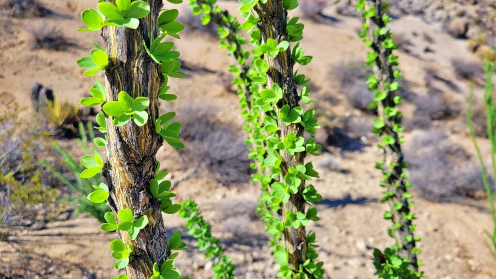
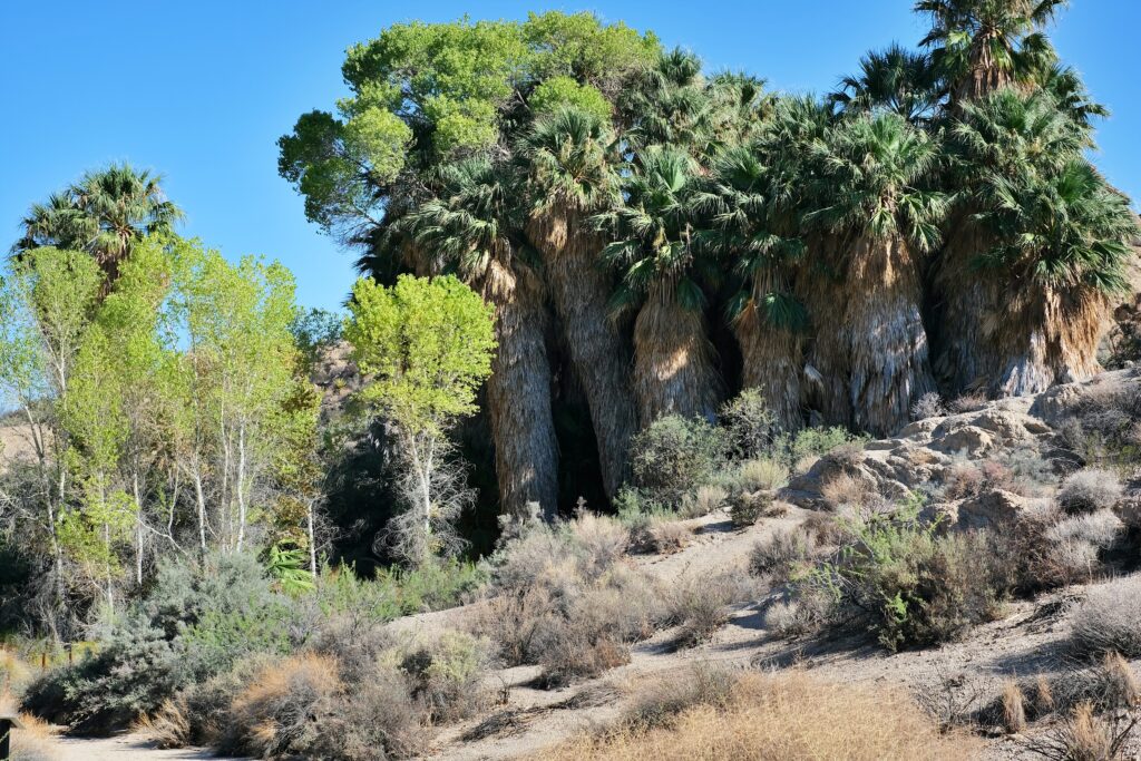
COTTONWOOD SPRING
This beautiful oasis is located just seven miles from the south entrance to the park. Here you will discover a hidden treasure trove of giant palm trees. This oasis is a true wonder, as up to 500 gallons (about 1,900 liters) of water can reach the surface of the earth daily. The water-rich soil found here provides a rare habitat within the park for native fan palms, some of which are said to be over 100 years old. It is a real treat, believe me. The area also features classic desert cottonwood trees.
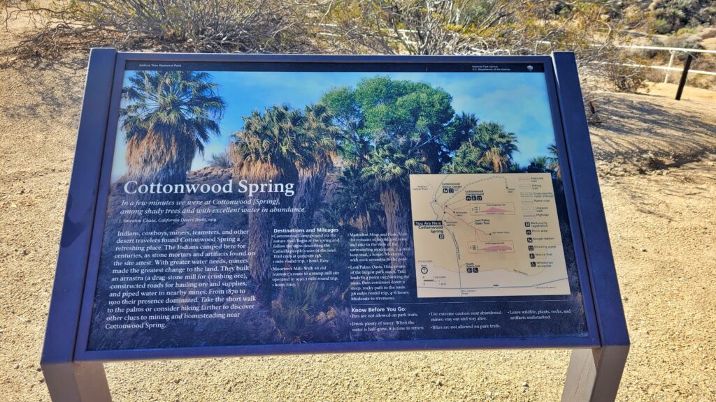
The oasis was created by an earthquake and for centuries the local Kavi tribe called the area home. The rock mortars they used are still clearly visible along the trail. Gold was mined here in the late 19th century.
The rock mortars they used are still clearly visible along the trail. Gold was mined here in the late 19th century.
From the parking lot, you can reach the first giant palm trees in a short time. I went on a short hike here.
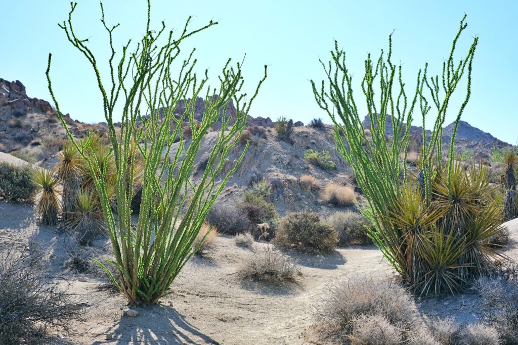
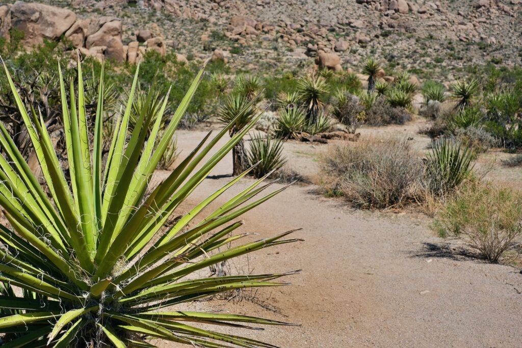
Ocotillo, smoke tree, and jojoba are some of the classic Colorado desert plants you will see on this hike.

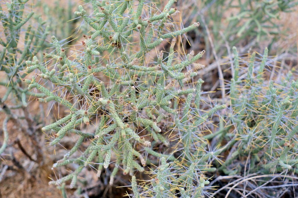
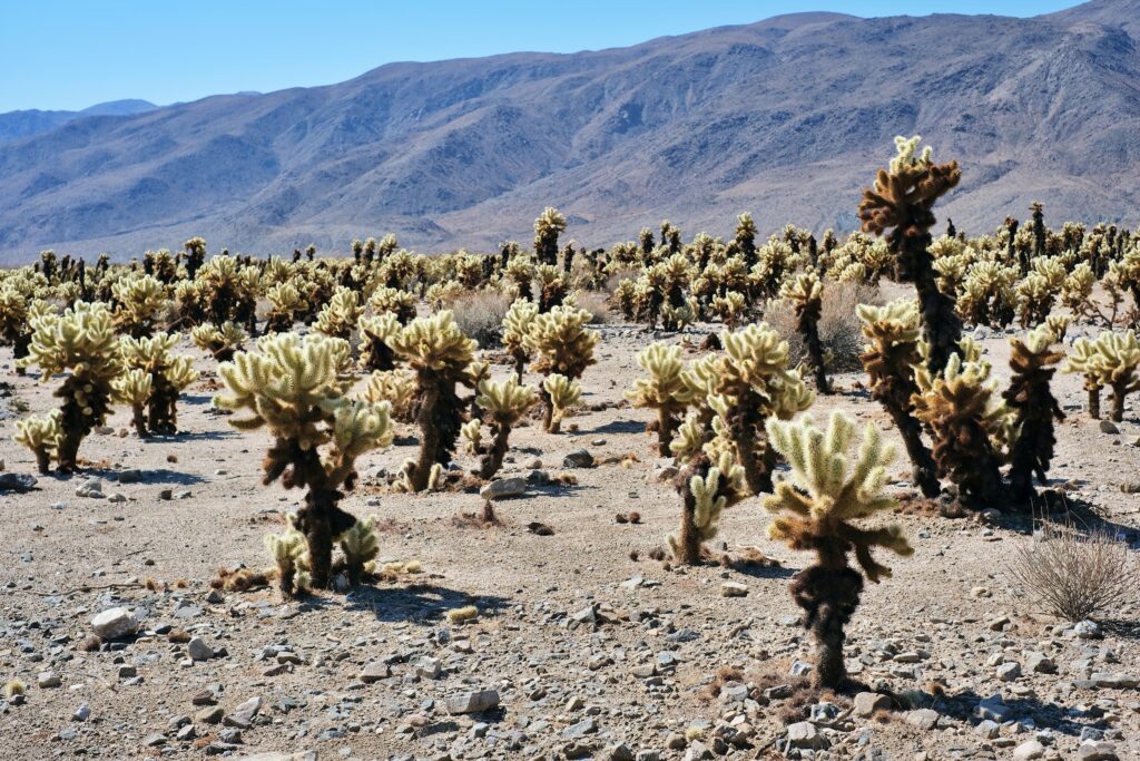
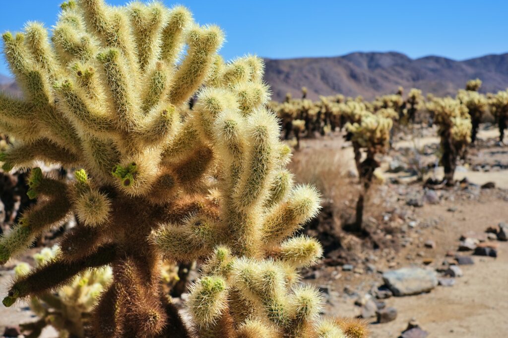
CHOLLA CACTUS GARDEN
The garden is located about halfway between the park entrance and the town of Joshua Tree, so it is easy to find. When you arrive, you will be surrounded by an oasis of tall cacti and lush vegetation. This garden is home to a variety of cacti, including the giant cholla cactus. This cactus can grow up to 15 meters tall.
DO YOU KNOW THE CHOLLA CACTUS?
DON’T TOUCH IT!
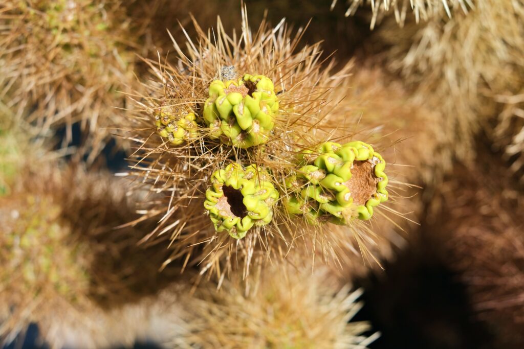
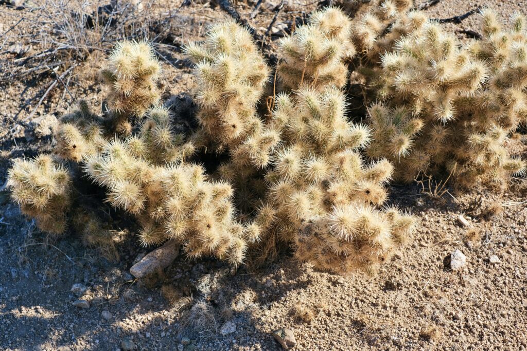
This is perhaps the cutest cactus on the planet. It is also called the “teddy bear cactus” or “jumping cactus”. The cactus is really cute and has a furry appearance. However, you don’t want to hug this teddy bear!
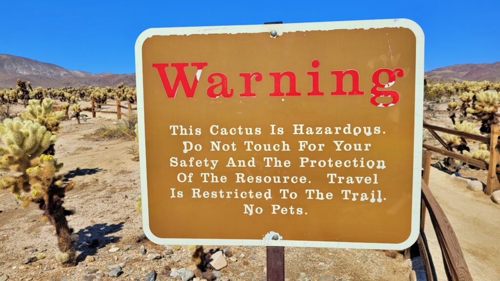
As you get closer, you’ll notice that the cactus isn’t hairy, but rather covered in spines. These will stick to your skin at the slightest touch. The spines on cholla cacti are difficult to remove once they’ve attached themselves to something (or someone). This defense mechanism is effective for desert survival, but it can be a bit of a pain for those who don’t stick to the trail.
There are thousands and thousands of Cholla cacti growing in this garden. So be careful to stay on the path! Although you can easily walk the path in less than 30 minutes, allow an hour to appreciate all the fantastic views of the cacti.
Cholla cacti are a popular target for photographers due to their unique anatomy and beautiful flowers. I tried to photograph them respectfully, but please be careful when photographing this plant.

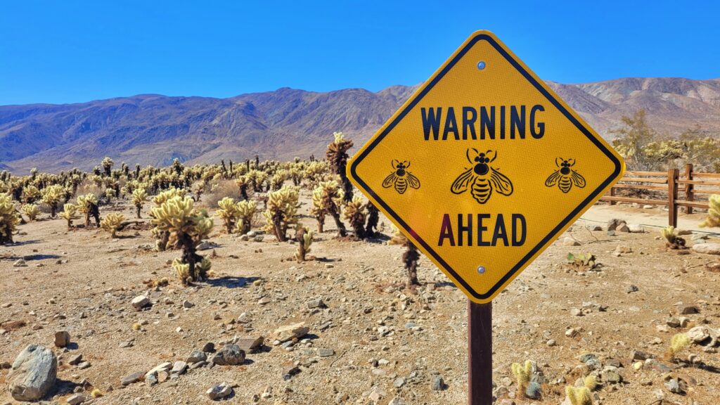
BEWARE OF THE BEES!
There are big signs in the cactus garden warning of bees. If you are allergic to bee stings, this may not be the place for you. There wasn’t much bee activity during my morning visit, but I’m not sure how it is later in the day. The garden was completely quiet, so I imagine the buzzing of the bees would be audible, which would help you avoid them.
MY TIP:
Dress appropriately. Depending on the time of year you choose to visit the desert, it can get surprisingly cold at night. And if you plan to, bring a hat, sunscreen, and water. There is no shade in the cactus garden. Bring closed-toe shoes. Be sure to protect your feet in case you come into contact with a cholla cactus. There are also loose cactus spines scattered throughout the soil, which you don’t want to have in your sandals. It’s best to be prepared.

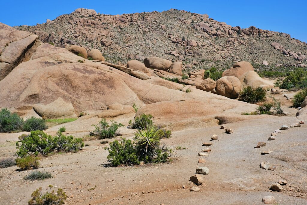
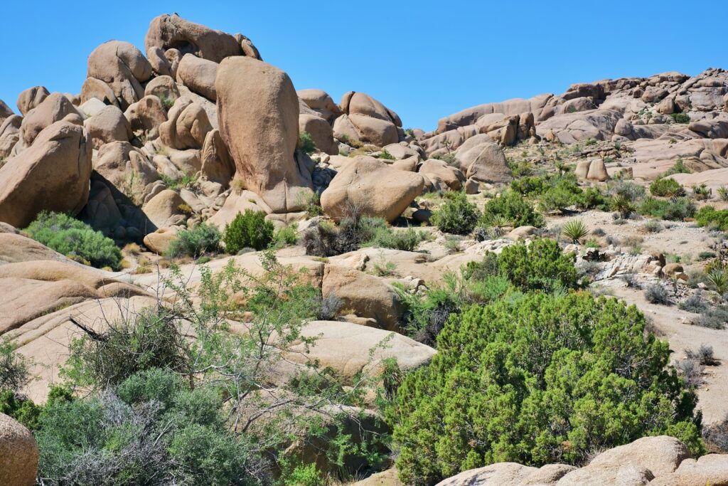
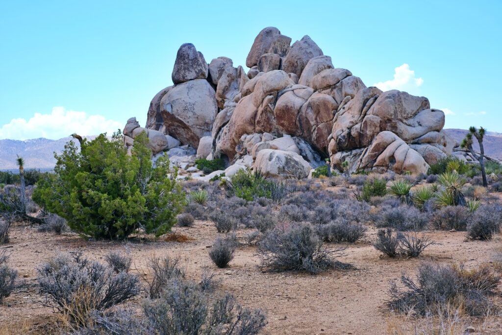
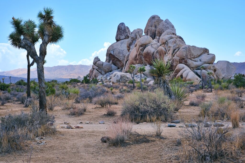
SPLIT ROCK LOOP TRAIL
The Split Rock Loop Trail is a moderately difficult trail. It’s not as busy as other trails in the park (like Hidden Valley or Barker Dam), but it offers some really nice rock formations, Joshua trees, and incredible views.
Yes, this is the trail where I got lost and confused it with the SKULL ROCK TRAIL.

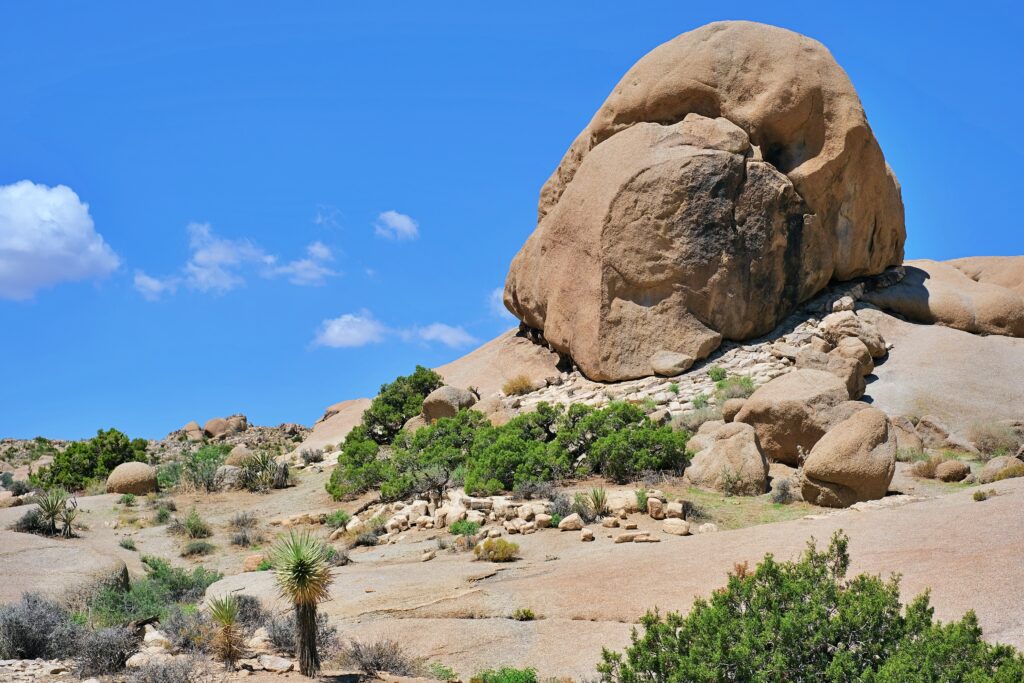
STOP AT SKULL ROCK
Along the way, stop at Skull Rock. This rock formation is located along the main east-west road in the park and is a popular stop for park visitors. The parking lot is directly across from the rock. If you want to stretch your legs, you can walk the 1.7 km long nature trail. And how did this rock form? Raindrops collected in small depressions and began to erode the granite. As the rock eroded, more water accumulated in it. This led to further erosion, until over time two hollowed-out eye sockets formed and the rock began to resemble a skull.
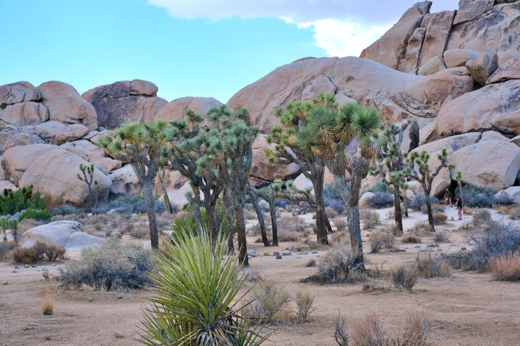
HIDDEN VALLEY
A trail runs through this valley, occasionally passing through the park’s characteristic monzogranite boulder piles. I only walked a short distance because a large cloud formed over the valley and it started to rain.

HOW TO GET TO THE PARK?
From Downtown Los Angeles: The route is 146 miles long and takes 2.5-3.5 hours depending on traffic. Google Maps will direct you to the north entrance to the Oasis as the fastest route. However, you can easily drive through Palm Springs and use the south entrance at Cottonwood Springs. This would take you from south to north through the park.
From Palm Springs: It’s about an hour to the entrance to Oasis or Cottonwood Spring. Again, I would recommend going through one entrance in and out through the other. That’s what we did, though.
From Las Vegas: It’s 187 miles from Las Vegas to the Oasis entrance. Honestly, I don’t recommend taking a day trip to Joshua Tree from Las Vegas. Just driving will take you 3 hours each way. But if you insist, use the Oasis gate to enter and exit. Try to leave some time to explore the sand dunes of the Mojave National Preserve, which you’ll pass through on the way. You can also do a circuit that starts in Las Vegas and then takes a road trip through both Joshua Tree and Death Valley.

WHERE TO STAY NEAR THE PARK?
The best accommodation options near the national park can be found in nearby towns. I stayed in Palm Desert. From there it is about 1 hour to the south gate near the COTTONWOOD VISITOR CENTRE. You can also find several excellent resorts and hotels in Palm Springs, but Palm Desert was both closer and cheaper for us.

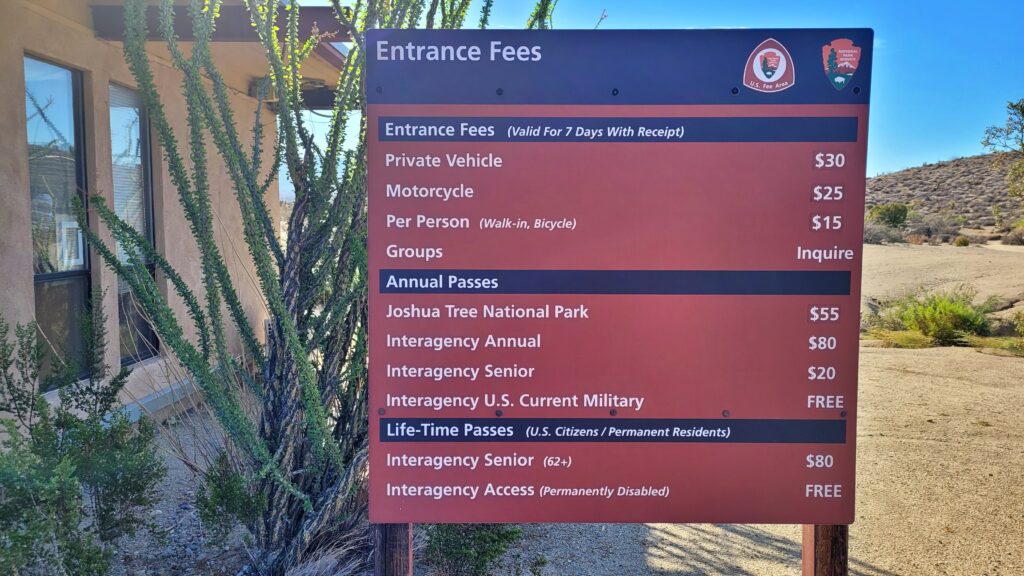
IS THERE A PAYMENT FOR ENTRANCE TO THE PARK?
Yes, there is a fee to enter the park. A seven-day permit for a vehicle costs $30. For $80, you can purchase an annual national park pass, which is worth it if you also plan to visit Death Valley, Yosemite, or other national parks in California.
WHEN IS THE PARK OPEN?
Joshua Tree is open year-round. The visitor centers are open from 8 a.m. to 5 p.m., but the park gates are always open. This means you can come and go at any time. If you’re coming from Los Angeles or Palm Springs, I recommend visiting the COTTONWOOD VISITOR CENTRE. You’ll get a free paper map, you can buy park admission, and you’ll also find a few books about the park and souvenirs.

HOW TO AVOID CROWDS?
There are two ways to do this: go early and stay longer OR visit the park during weekdays.
OPTION A
For the “go early and stay longer” option, you need to arrive the night before, but in time to stop at the visitor center, where you can get maps and some advice. Since the park is open 24/7, head out very early in the morning. If you haven’t purchased your ticket yet, don’t worry. You’ll be charged for it when you leave. If you’re doing Joshua Tree as a day trip from Palm Springs, Los Angeles, or Las Vegas, then stop at the visitor center upon arrival and plan to stay in the park until late.
OPTION B
Joshua Tree is a very popular park, so if you can manage it, try to go there midweek. There are times when the park is less crowded. I visited the park at the end of August, and the American kids were already in school, so there weren’t that many people. And it was 37 C during the day, so walking in that heat wasn’t exactly pleasant.

WHEN IS THE BEST TIME TO VISIT THE PARK?
Average high temperatures range from June to September, with some trails and campgrounds in the park not even open in the summer. Any other time of year is better, and March/April and October/November are wonderful. As I mentioned, I was there in the summer and it was bearable.
WHAT MAP DO YOU GET IN THE PARK?
The park offers two types of maps: a neat brochure-style map and a newspaper-style map. Each has good information about the most popular parts of the park. However, neither of them shows all the trails. If you’re interested in getting off the beaten path and exploring something off-the-beaten-path, ask for suggestions at the visitor center. The All Trails app and website also do a better job of listing all the trails, and you can use the app without a data connection.

HOW CAN I EAT IN THE PARK?
Park services are very limited. There are parking lots, rest areas, restrooms, and picnic tables scattered throughout the park. However, there are no cafes or souvenir shops in the park itself. You can only purchase souvenirs at the Information Center. Bring enough food, snacks, water, and other refreshments for your entire day in Joshua Tree.

If you liked the article, I would be happy if you share it or leave a nice comment below the article.
If you liked the article, I would be happy if you share it or leave a nice comment below the article.

I would also like to invite you to join me on Instagram and Facebook.

MORE ARTCLES
NATIONAL PARKS AND NATURE


CITIES


